Stay Up to Date
Subscribe to our quarterly updates for all the latest MinEx CRC news
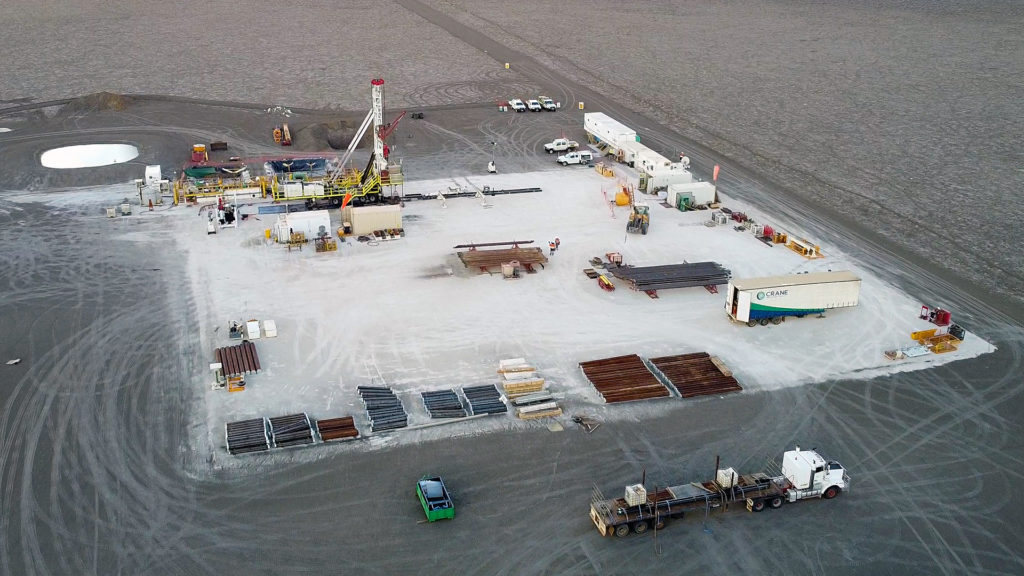
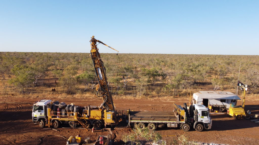
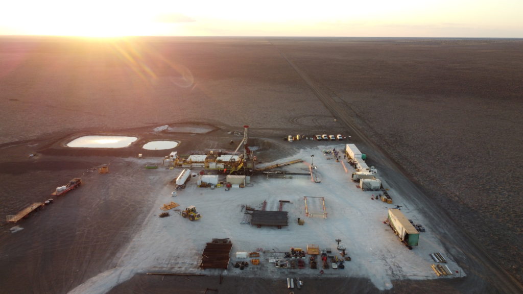
The National Drilling Initiative (NDI) will manage and deliver drilling programs in multiple case study areas proposed by MinEx CRC’s partner geological survey organisations. The NDI vision is to drill multiple holes in a region to map the regional geology and architecture and define the potential for mineral systems in 3D. A range of drilling methods may be used however it is intended that the NDI will take advantage of new low-cost Coiled Tubing (CT) drilling technology and associated sensing, in order to maximise the number of drill holes and the volume of data collected.
General Information:
The purpose of the Northern Gawler Craton NDI Project is to undertake a scientific drilling program to improve geological knowledge in the Northern Gawler Craton area of South Australia. This work will contribute to an existing precompetitive geoscience program which seeks to improves our understanding of the mineral, energy, and groundwater potential of the region.
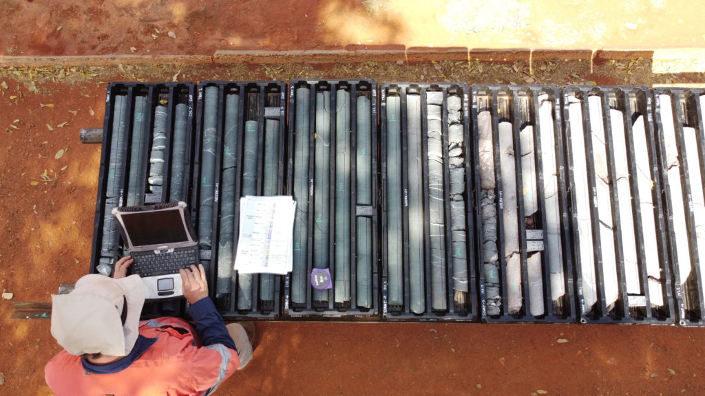
The project will collect physical samples such as drill core and chips and downhole data from a series of boreholes that will yield information about the order and position of Proterozoic crystalline basement rocks in the Northern Gawler Craton region. These stratigraphic boreholes will be up to 500m deep.
Project Update:
Drilling for this Campaign commenced in October 2024.
A region of 14,545 km2 located predominantly over the Billa Kalina, Coober Pedy, Murloocoppie and Warrina map sheets was gazetted under Section 15 of the Mining Act 1971 on 23 November 2023. To put this in perspective, this is an area larger than the state of Connecticut in the United States of America.
October 2024.
The purpose of the Northern Gawler Craton NDI Project is to undertake a scientific drilling program to improve geological knowledge in the Northern Gawler Craton area of South Australia. Downhole drilling data can be used to map the geology and structure of the Earth. The data will be used to learn more about how the South Australian Craton evolved throughout geological time.
The program will contribute to new data to map potential groundwater resources and understanding the potential for new mineral reserves.
The knowledge learned from our program will be made available to all stakeholders, and data will be accessible using our South Australian Resource
Information Gateway (SARIG) online data portal: https://map.sarig.sa.gov.au/
This work is part of a long-running precompetitive geoscience program which will improve understanding of the region’s mineral, energy and groundwater potential.
Coming soon…
Drilling conducted by MinEx CRC and the Geoscience Australia has now concluded.
The purpose of the Delamerian Margins NSW National Drilling Initiative (NDI) project was to undertake a pre-competitive geoscience research program and answer fundamental science questions to promote future mineral exploration and discovery in the Delamerian arc area of western New South Wales.
The new data will be considered with existing datasets derived from the Geoscience Australia (GA) Stavely Project, the MinEx CRC-Geological Survey of South Australia (GSSA) Delamerian NDI, geological survey of New South Wales (GSNSW) mapping and industry legacy data as part of the Exploring for the Future (EFTF) Darling-Curnamona-Delamerian (DCD) project.
The combined data will provide a broader overview of the tectonostratigraphic evolution and mineral potential of the Cambrian Delamerian arc rocks, and younger intrusive rocks.
The National Drilling Initiative (NDI) manages and delivers drilling programs in multiple case study areas proposed by MinEx CRC’s partner geological survey organisations. The NDI vision is to drill multiple holes in a region to map the regional geology and architecture and define the potential for mineral systems in 3D.
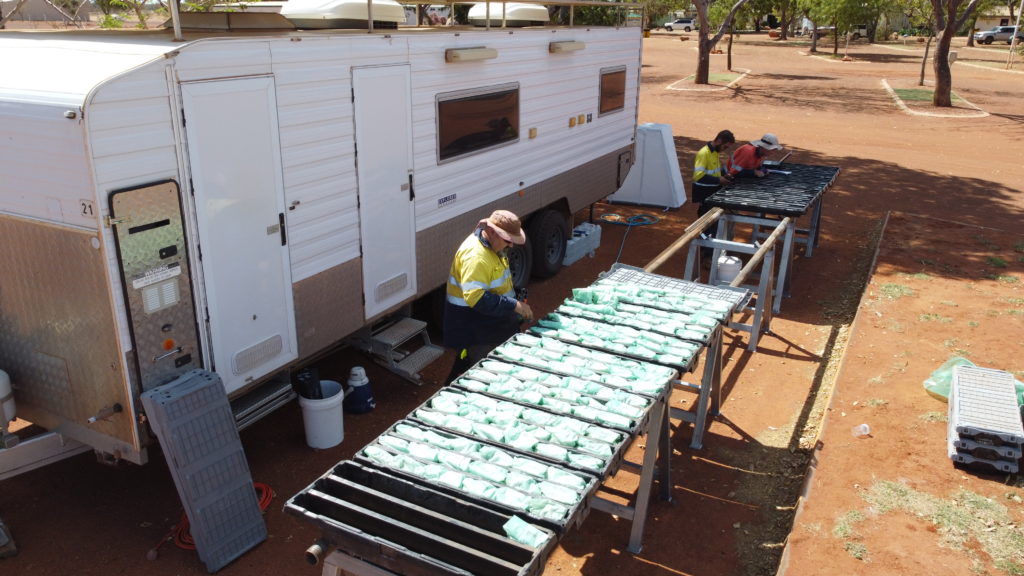
In addition to conventional drilling methods, the NDI is utilising new low-cost Coiled Tubing (CT) drilling technology and associated sensing developed by MinEx CRC. This technology minimises the environmental footprint and maximises the number of drill holes and the volume of data collected.
The National Drilling Initiative is not an exploration program itself, rather it seeks to provide new evidence about the existence of mineralising systems for exploration companies to then come in and take up the search and lower the risk for companies to explore previously poorly understood areas.
MinEx CRC is conducting the drilling program in collaboration with the Geoscience Australia as part of a long-running precompetitive geoscience program.
MinEx CRC, representing its Industry Participants GA and GSNSW, seeks to obtain samples from a series of boreholes up to ~500 m deep into the Phanerozoic basement rocks in the Loch Lilly-Kars (LLK) region, and up to ~800 m deep in the Wentworth-Mildura-Pooncarie (WMP) region of western NSW. Borehole samples will include Coiled Tubing (CT) drilling rig chips, diamond drill core and reverse circulation or mud rotary chips, as well as a suite of borehole wireline geophysical data and evolved gas samples. Selected boreholes may also be repurposed as geothermal monitoring bores by AuScope, subject to landholder permission.
Boreholes will be drilled across the Project area in order to target specific basement rock packages. Samples from these boreholes will be analysed in order to assess covered tectonostratigraphy and develop interpretations of mineral systems models by obtaining new geological, geochemical, petrophysical and geochronological data in the identified data gaps.
In support of the NDI project, MinEx CRC has acquired title to parcels of land in NSW under Exploration Licences (EL) EL9457, EL9458 and EL9459.
Physical Samples and Data acquired during stratigraphic drilling in the Project will be analysed as part of MinEx CRC Program 3 (National Drilling Initiative) in order to develop models and interpretations of under-cover mineral systems by obtaining new geological, geochemical, petrophysical and geochronological data in areas with identified data gaps.
The Project and MinEx CRC Program 3 seek to provide Physical Samples and pre-competitive Data that improves the understanding of the geology of the western NSW portion of the Delamerian Orogen.
The outcomes of the Project will support better-informed planning decisions by government and exploration decisions by industry, and support better outcomes for the region, New South Wales, South Australia and Australia.
Borehole completion reports and HyLogger datasets from the Delamerian Margins NDI Campaign are now available to download below.
Drilling method: RoXplorer® CT500/Diamond
Collar location: 141.09094, -32.568075
Drill depth: 174.3 m
Borehole completion report: https://portal.ga.gov.au/bhcr/minerals/867065?persona=minexcrc
Borehole name: NDILLK02
Drilling method: RoXplorer® CT500
Collar location: 141.0905457, -32.6242497
Drill depth: 63 m
Borehole completion report: https://portal.ga.gov.au/bhcr/minerals/867067?persona=minexcrc
Borehole name: NDILLK03
Drilling method: RoXplorer® CT500/Diamond
Collar location: 141.00119, -32.825529
Drill depth: 177.14 m
Borehole completion report: https://portal.ga.gov.au/bhcr/minerals/867079?persona=minexcrc
Borehole name: NDILLK04
Drilling method: RoXplorer® CT500/Diamond
Collar location: 141.00121, -32.82756
Drill depth: 183.24 m
Borehole completion report: https://portal.ga.gov.au/bhcr/minerals/867078?persona=minexcrc
Borehole name: NDILLK05
Drilling method: RoXplorer® CT500/Diamond
Collar location: 141.36899, -32.577679
Drill depth: 191.1 m
Borehole completion report: https://portal.ga.gov.au/bhcr/minerals/867069?persona=minexcrc
Borehole name: NDILLK06
Drilling method: RoXplorer® CT500/Diamond
Collar location: 141.3855, -32.57974
Drill depth: 138.5 m
Borehole completion report: https://portal.ga.gov.au/bhcr/minerals/867070?persona=minexcrc
Borehole name: NDILLK07
Drilling method: RoXplorer® CT500/Diamond
Collar location: 141.38124, -32.517491
Drill depth: 173 m
Borehole completion report: https://portal.ga.gov.au/bhcr/minerals/867081?persona=minexcrc
Borehole name: NDILLK08
Drilling method: RoXplorer® CT500/Diamond
Collar location: 141.37051, -32.508862
Drill depth: 175.57 m
Borehole completion report: https://portal.ga.gov.au/bhcr/minerals/867071?persona=minexcrc
Borehole name: NDILLK09
Drilling method: RoXplorer® CT500/Diamond
Collar location: 141.047067, -33.08748
Drill depth: 272.15 m
Borehole completion report: https://portal.ga.gov.au/bhcr/minerals/867072?persona=minexcrc
Borehole name: NDILLK10
Drilling method: RoXplorer® CT500/Diamond
Collar location: 141.12662, -33.134266
Drill depth: 404.05 m
Borehole completion report: https://portal.ga.gov.au/bhcr/minerals/867074?persona=minexcrc
Borehole name: NDILLK11
Drilling method: MR/Diamond
Collar location: 141.09153, -32.554047
Drill depth: 369.9 m
Borehole completion report: https://portal.ga.gov.au/bhcr/minerals/867064?persona=minexcrc
Borehole name: NDILLK12
Drilling method: MR/Diamond
Collar location: 141.09158, -32.591466
Drill depth: 237.8 m
Borehole completion report: https://portal.ga.gov.au/bhcr/minerals/867066?persona=minexcrc
Borehole name: NDILLK13
Drilling method: MR/Diamond
Collar location: 141.10427, -32.66034
Drill depth: 255.7 m
Borehole completion report: https://portal.ga.gov.au/bhcr/minerals/867068?persona=minexcrc
Borehole name: NDILLK14
Drilling method: MR/Diamond
Collar location: 141.07887, -33.138942
Drill depth: 435.0 m
Borehole completion report: https://portal.ga.gov.au/bhcr/minerals/867075?persona=minexcrc
Borehole name: NDIWMP01
Drilling method: RoXplorer® CT1000
Collar location: 141.9983983, -33.7638968
Drill depth: 700.0 m
Borehole completion report: https://portal.ga.gov.au/bhcr/minerals/869994?persona=minexcrc
Borehole name: NDIWMP02
Drilling method: MR/Diamond
Collar location: 141.62446, -33.49948
Drill depth: 646.3 m
Borehole completion report: https://portal.ga.gov.au/bhcr/minerals/867077?persona=minexcrc
Borehole name: NDIWMP03
Drilling method: MR/Diamond
Collar location: 141.42508, -33.768776
Drill depth: 554.7 m
Borehole completion report: https://portal.ga.gov.au/bhcr/minerals/867080?persona=minexcrc
Coming soon…
Drilling conducted by MinEx CRC and the Geological Survey of South Australia has now concluded.
Further information on the Delamerian Orogen NDI Campaign can be found via the Geological Survey of South Australia webpage here.
The National Drilling Initiative (NDI) manages and delivers drilling programs in multiple case study areas proposed by MinEx CRC’s partner geological survey organisations. The NDI vision is to drill multiple holes in a region to map the regional geology and architecture and define the potential for mineral systems in 3D.
In addition to conventional drilling methods, the NDI is utilising new low-cost Coiled Tubing (CT) drilling technology and associated sensing developed by MinEx CRC. This technology minimises the environmental footprint and maximises the number of drill holes and the volume of data collected.
The National Drilling Initiative is not an exploration program itself, rather it seeks to provide new evidence about the existence of mineralising systems for exploration companies to then come in and take up the search and lower the risk for companies to explore previously poorly understood areas.
MinEx CRC is conducting the drilling program in collaboration with the Geological Survey of South Australia as part of a long-running precompetitive geoscience program.
The Cambrian-Ordovician Delamerian Orogen is an arcuate orogenic belt with a strike length of approximately 15,000 km, encompassing eastern South Australia, western New South Wales, western Victoria and central and western Tasmania. It preserves the remnant of an accretionary plate margin formed along the eastern margin of the proto-Australian continent when it was part of the supercontinent Gondwana. The basement to the Murray Basin in South Australia is arguably the most poorly understood element of the Delamerian Orogen, flanked to the west by deformed Neoproterozoic-Middle Cambrian sedimentary rocks of the Adelaide Fold Belt, and to the east by volcanic arcs of the Grampians Stavely Zone in Victoria, and the Koonenberry and Loch Lily-Kars belt in NSW.
While the cover succession of the Murray Basin continues to be the target of exploration for heavy mineral sands, exploration for base and precious metals within the Delamerian basement has until now been almost solely focused along the western margin of the Murray Basin. This project will provide new constraints on the geological setting, deformational history, thickness of cover and prospective mineral systems of the basement beneath the Murray Basin.
Drilling has now concluded.
For further information on the Delamerian Orogen NDI Campaign, please see the Geological Survey of South Australia website.
To stimulate mineral exploration beneath cover of the Murray Basin by providing industry with new data and new constraints on the geological framework and mineral prospectivity in this greenfields region
Any general enquiries can be directed to admin@minexcrc.com.au
Throughout the project resources will be released to give a greater understanding of the Delamerian basement. These are designed to provide additional support to the exploration industry. You can access the full list of data releases, publications and maps through SARIG.
December 2021:
Precompetitive Review: ‘Delamerian NDI campaign hits its mark: Fe and Cu sulphides, extensive porphyry Cu-style alteration, and a VMS play as well’
Precompetitive Review: ‘MinEx CRC’s Coiled Tube Rig ready to deliver low-cost drilling revolution after success with Delamerian NDI campaign’
September 2021:
Precompetitive Review: ‘NDI gets underway in the Delamerian as new MT highlights Cu and Au potential’
The MinEx CRC tenement held in the Northern Territory for the South Nicholson NDI Campaign expired in mid-July 2021 and will not be renewed (EL32366).
Please utilise STRIKE to ascertain the Moratorium End Date under the “Mineral Titles/Exploration Licences – 30-day Moratorium” convention.
Based on the MinEx ceased tenure date, we estimate that ground will be open for application on 13/8/2021.
Geoscience Australia and MinEx researchers have taken the below list of samples and for which analysis is currently underway.
Additional samples have been taken (as is evidenced in the core trays), and further information will be made available here as analyses are progressed.
Any samples taken which are not analysed will be returned to the core trays.
Download the Sampling and Analysis list here.
The Borehole Completion Report, HyLogger and Minalyze data packages for the South Nicholson Campaign are available below:
Borehole Completion Report: NDI Carrara 1
HyLyogger Data Package: https://geoscience.nt.gov.au/gemis/ntgsjspui/handle/1/91582
Minalyze Data Package: https://minalogger.com/viewer/?project=NDI&hole=NDICARRARA1
In order to access the Minalyze Data Packages please create a (free) account via the link:https://minalogger.com/register/
A video tutorial on how to navigate the Minalyze cloud interface can be accessed here.
NT News: ‘New wave of explorers eye the Northern Territory new data released from National Drilling program’
ABC Radio: ‘Outback NT Rural Report’
Mirage News: ‘First data released from National Drilling Initiative’s South Nicholson Campaign’
The Adelaide Advertiser: ‘New wave of explorers eye the Northern Territory – new data released from the National Drilling Program’
The Courier Mail: ‘New wave of explorers eye the Northern Territory – new data released from the National Drilling Program’
The Geelong Advertiser: ‘New wave of explorers eye the Northern Territory – new data released from the National Drilling Program’
ForeignAffairs.co.nz: ‘First data released from National Drilling Initiative’s South Nicholson campaign’
The Daily Telegraph: ‘New wave of explorers eyeing the Territory: Pitt’
The Townsville Bulletin: ‘New wave of explorers eyeing the Territory: Pitt’
The Herald Sun: ‘New wave of explorers eyeing the Territory: Pitt’
The Cairns Post: ‘New wave of explorers eyeing the Territory: Pitt’
The Mercury: ‘New wave of explorers eye the Northern Territory: Pitt’
MinEx CRC tenements held in the Northern Territory for the East Tennant NDI Campaign expired in mid-July 2021 and will not be renewed (EL32362, EL32363, EL32364, EL32365).
Please utilise STRIKE to ascertain the Moratorium End Date under the “Mineral Titles/Exploration Licences – 30-day Moratorium” convention.
Based on the MinEx ceased tenure date, we estimate that ground will be open for application on 13/8/2021.
Data is available via the MinEx CRC National Drilling Initiative (NDI) Portal
Borehole Completion Reports, HyloggerMinalyze data packages and a Sampling and Analysis list are available below.
In order to access the Minalyze Data Packages please create a (free) account via the link: https://minalogger.com/register/
A video tutorial on how to navigate the Minalyze cloud interface can be accessed here.
Geoscience Australia and MinEx researchers have taken the below list of samples and for which analysis is currently underway.
Additional samples have been taken (as is evidenced in the core trays), and further information will be made available here as analyses are progressed.
Any samples taken which are not analysed will be returned to the core trays.
Download the Sampling and Analysis list here.
Collar location: 136.1256, -19.5719
Drill Depth: 351.8 m
Borehole Completion Report: https://portal.ga.gov.au/bhcr/minerals/648462?persona=minexcrc
Hylogger Data Package: https://geoscience.nt.gov.au/gemis/ntgsjspui/handle/1/91247
Minalyze Data Package: https://minalogger.com/viewer/?project=NDI&hole=NDIBK01
Collar location: 136.0107, -19.5397
Drill depth: 347.0 m
Borehole Completion Report: https://portal.ga.gov.au/bhcr/minerals/648481?persona=minexcrc
Hylogger Data Package: https://geoscience.nt.gov.au/gemis/ntgsjspui/handle/1/91258
Minalyze Data Package: https://minalogger.com/viewer/?project=NDI&hole=NDIBK02
Collar location: 35.9464, -19.5569
Drill depth: 350.7 m
Borehole Completion Report: https://portal.ga.gov.au/bhcr/minerals/649159?persona=minexcrc
Hylogger Data Package: https://geoscience.nt.gov.au/gemis/ntgsjspui/handle/1/91251
Minalyze Data Package: https://minalogger.com/viewer/?project=NDI&hole=NDIBK03
Collar location: 136.2904, -19.5342
Drill depth: 416.3 m
Borehole Completion Report: https://portal.ga.gov.au/bhcr/minerals/650764?persona=minexcrc
Hylogger Data Package: https://geoscience.nt.gov.au/gemis/ntgsjspui/handle/1/91259
Minalyze Data Package: https://minalogger.com/viewer/?project=NDI&hole=NDIBK04
Collar location: 135.7949, -19.8483
Drill depth: 293.8 m
Borehole Completion Report: https://portal.ga.gov.au/bhcr/minerals/650765?persona=minexcrc
Hylogger Data Package: https://geoscience.nt.gov.au/gemis/ntgsjspui/handle/1/91252
Minalyze Data Package: https://minalogger.com/viewer/?project=NDI&hole=NDIBK05
Collar location: 135.9797, -19.1644
Drill depth: 504.7 m
Borehole Completion Report: https://portal.ga.gov.au/bhcr/minerals/650787?persona=minexcrc
Hylogger Data Package: https://geoscience.nt.gov.au/gemis/ntgsjspui/handle/1/91253
Minalyze Data Package: https://minalogger.com/viewer/?project=NDI&hole=NDIBK06
Collar location: 136.3461, -19.1945
Drill depth: 274.0 m
Borehole Completion Report: https://portal.ga.gov.au/bhcr/minerals/650881?persona=minexcrc
Hylogger Data Package: https://geoscience.nt.gov.au/gemis/ntgsjspui/handle/1/91254
Minalyze Data Package: https://minalogger.com/viewer/?project=NDI&hole=NDIBK07
Collar location: 136.2156, -19.3298
Drill depth: 347.8 m
Link: https://portal.ga.gov.au/bhcr/minerals/650882?persona=minexcrc
Hylogger Data Package: https://geoscience.nt.gov.au/gemis/ntgsjspui/handle/1/91255
Minalyze Data Package: https://minalogger.com/viewer/?project=NDI&hole=NDIBK08
Collar location: 136.0323, -19.4992
Drill depth: 315.5 m
Borehole Completion Report: https://portal.ga.gov.au/bhcr/minerals/650883?persona=minexcrc
Hylogger Data Package: https://geoscience.nt.gov.au/gemis/ntgsjspui/handle/1/91256
Borehole name: NDIBK10
Collar location: 135.8957, -19.7757
Drill depth: 765.7 m
Borehole Completion Report: https://portal.ga.gov.au/bhcr/minerals/650908?persona=minexcrc
Hylogger Data Package: https://geoscience.nt.gov.au/gemis/ntgsjspui/handle/1/91257
Any general enquiries can be directed to admin@minexcrc.com.au
March 2021:
‘National Drilling Initiative Reveals Golden Opportunity for Northern Australia’
‘National drilling initiative reveals golden opportunity for northern Australia’
March 2021:
February 2021:
January 2021:
December 2020: